Some of these streams, in cutting their way out through the eastern mesa or foot-hills, have worn deep canons and wonderful gorges through the mountains on their way to the plains below. After passing out on the plain and reaching the dry and thirsty soil, most of these beautiful streams become swallowed up by the thirsty sands and are lost. They sink beneath the surface and with one exception only (Rapid Creek) they fail to reach the river during the summer season.
French Creek.
French Creek, in Custer County, of three hundred miner's inches, rises
on the western rim and flows eastward for fifteen miles through a beautiful,
elevated park country, then plunges into a deep and rugged canon, from which
it does not emerge for twenty miles, until it reaches the plain and soon
sinks out of sight. Custer City is situated on this stream at a point before
it leaves the beautiful park country we have described. French Creek is well
supplied with timber, and the soil in the park country named is well adapted
to agriculture. The stream becomes very small during the summer, some
seasons very little water running in it during the dry months of the year.
Considerable
gold is found along the stream, north of French Creek, and in
Pennington County is Spring Creek, of seven hundred miner's inches. It runs
eastward by a tortuous course through deep and narrow valleys and rugged
canons, and finally cuts its way through the great eastern mesa and is lost
on the plain. With a fine, deep bed, it carries no water out of the hills.
Gold is found in considerable quantities along this stream and
its
tributaries, and it has ample water for sluicing. It offers but little
inducement to the agriculturist, the valleys being small and the country
very mountainous.
Spring and Rapid
Creeks.
Rockerville is situated a few miles from its banks and the town of
Sheridan on this stream. Pennington County has also two other large streams,
Rapid Creek and the Boxelder. The former, of two thousand miner's inches, is
one of the largest streams in the Black Hills, and the only one that cuts
through the eastern rim which escapes the thirsty secondary, and pours
eastward across the plain to the Cheyenne River. Many small streams unite to
form it, and among these, Little Rapid and Castle Creeks are the most
prominent. The gold diggings on Castle Creek have been among the richest of
the Black Hills. Rapid Creek also passes through a deep canyon on its way
out to the plain. Rapid City is situated on this stream at a point whence
leaving the canyon the stream enters a lovely valley or plain which offers
one of the choicest spots in this country for the settler. There are many
other towns on this stream and its branches, among them, Rochford, on Little
Rapid Creek, and Castleton, on Castle Creek. From source to mouth it is a
fine stream and probably the most valuable for all purposes of any in the
Hills.
The Boxelder Creek
Has water flows of three hundred miner's inches, and lies a few miles
north of Rapid Creek. It runs in an eastward direction generally parallel to
it. It has some silver and
copper ore deposits within the territory it drains, but no
gold discoveries nor towns of importance along its banks.
Bear Butte Creek.
Bear Butte Creek rises in the northern rim of the hills in Lawrence
County, a few miles south of Deadwood, and runs north-east close to the
mountain from which it takes its name and empties into the Bellefourche. The
town of Galena and the rich
silver ore deposits there, are on the headwaters of this
stream, also the Government Military Post of Fort Meade, and Sturgis City
further down the stream. It carries but a few miner's inches of water.
Whitewood Creek,
Is Located in Lawrence County, and rises within the northern mesa
in the vicinity of Bald Mountain and Terry's Peak, and runs northward into
the Bellefourche. It has several small branches, the principal one being
Deadwood Creek, from which that city took its name, and which stream unites
with the Whitewood, within the limits of the city. This section was formerly
heavily timbered with pine and other woods along this stream, and was not
mentioned in the report of the expedition of 1875. The deposits of gold in
this gulch was the immediate cause of the great rush into this section in
1876. We have only space to mention one more stream of the many remaining
ones of the Black Hills.
Spearfish Creek
Scenery.
The Spearfish, also in Lawrence County, is a stream perhaps even larger
than Rapid Creek. It rises in the northern mesa in the vicinity of Bald
Mountain, runs north for many miles through the grandest, deepest canon of
the Hills, a chasm in many places not less than two thousand feet deep,from
which it emerges out on a valley or "bottom" of the richest soil more than a
mile wide, the finest agricultural valley of this county. This valley is
about seven miles long to where the Spearfish empties into the Redwater
River, which, ten miles farther on, empties into the Bellefourche. Spearfish
City is on this stream, and is the centre of the most flourishing
agricultural portion of the Black Hills no gold is found along this stream.
A project is planned for taking water from the headwaters of this creek and
carrying it in a ditch fifteen or twenty miles to the vicinity of Deadwood,
for the purpose of working the placer mines for
gold nuggets by hydraulic process. However, it is not yet
completed.
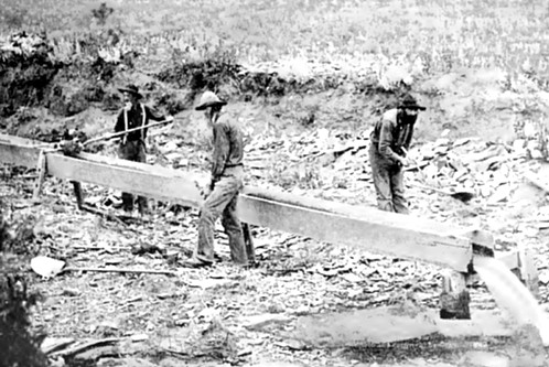
There are a few gold deposits on the headwaters of streams flowing through the northern mesa, but the streams are small ones Potato Gulch and Bear Gulch are among these, and from these gulches some gold has been extracted. The scenery along some of these streams and deep mountain gorges is magnificent. Foaming, dashing streams of clear, cool water rushing through canons so deep and narrow as almost to exclude the sunlight, except at noon, whose sides are so precipitous as to offer no foothold for man or beast, are common scenes in the Black Hills. A specimen of these appears opposite. Beautiful parks between hills, covered with luxuriant grasses and carpeted with lovely wild flowers are frequent on the headwaters of French and Spring Creeks. To the tourist or pleasure seeker they offer the grandest of sights and one of the fairest resorts in the world.
Return
to The South Dakota Page:
South Dakota Gold Rush History