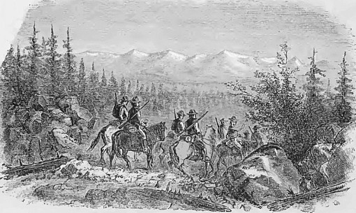
Discretion in Taking up Ground. Fortunate is
the man who has the instinctive ability to recognize a "mine" when he sees
it, and the courage to forbear locating every little seam of ore he may
encounter. Nearly every prospector is "location poor;" loaded up with
so-called mines, the bulk of which should never have been located; which he
is confessedly unable to work, and many of which were simply considered
"good enough to sell" when the notice of location was pasted. As a general
thing, nothing is worth locating, and it is only in exceptional cases that
anything is worth working, which has not a first-class surface showing
either in quantity or quality of ore. "Extensions" of good and proved mines
may be exceptions.
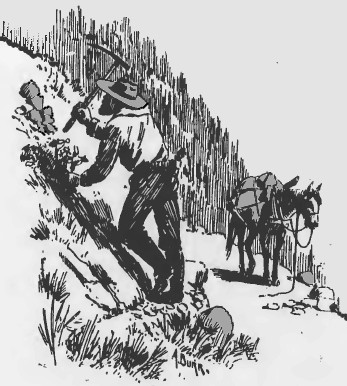
Accurate Observation and Description. It is a common remark among
prospectors, when the surface showing is not particularly promising, that it
is only necessary to gain depth to make a mine. We shall soon see that there
is no foundation for such a statement, when we come to consider the lesson
of the outcrop. But first let us look at the points which a prospector
should note about each of his locations as they are made, so that he may be
able to intelligently explain their condition to those whose aid he may
desire to develop them, remembering that all questions
which can be
answered positively should be so answered, and that on all other points an
underestimate is infinitely better than an overstatement.
If a man examining a mine for investment finds the representations honestly and accurately made, the first impression (always an important one) is favorable and likely to remain; but if first one discrepancy and then another is encountered, a feeling of distrust is created which may break off pending negotiations, while at the same time there has been no intention on the part of the owners to make a misstatement of facts. The trouble frequently arises from the use of terms in a loose way, so that they convey to the hearer a totally different impression from that intended by the speaker; or it may be altogether from a want of knowledge or misapprehension of the meaning of certain facts.
POINTS TO BE DETERMINED:
1. DISTANCE FOR WHICH THE VEIN OR DEPOSIT CAN BE TRACED. Not infrequently we
are told that the vein can be traced a mile, when in reality there are only
a series of isolated outcrops in a more or less straight line, with
intermediate barren or apparently barren spaces, often of considerable
extent. Strictly speaking, the distance for which the outcrop can be
followed without a break is all that should be called traced, but if the
vein lie at the contact of two different kinds of rock, and on following
this line of junction, even when no vein matter is visible, a second outcrop
be found on the contact, both outcrops may fairly be considered as on the
same lode. The same will be the case if the vein is formed on the wall of a
dike, in which case all ore bodies lying on the same side of the dike may be
called parts of the same vein. But as it seldom if ever happens that the
vein for its whole length is ore-bearing, the distance the vein itself can
be traced is of vastly less importance (except as indicating its strength
and probable continuance in depth) than the distance the ore body, the
really essential part of the vein, can be followed unbroken. This length
should be determined even if it takes some trouble.
Following Dikes and Contacts. In tracing an outcrop, or rather a vein, nature offers many indications. If following a dike, the latter is generally much larger than the vein and not infrequently harder than the rocks which it traverses, standing up above them, and can be taken as a guide. If the vein is on the contact of two rocks, and covered in places with earth or debris, it is only necessary to locate outcrops of the rocks on each side of the contact, and the search may safely be confined to the space between them. Narrow trenches through the surface dirt, run across the general line of the lode, will easily locate the contact and disclose the ore if it exists. The process is called "costeaning" by the Cornish miners.
Vegetation as a Guide. Sometimes the vegetation on the two different rocks, especially when decidedly unlike in composition, is so different that the line of contact may be traced by it alone. In open countries free from heavy timber, like Arizona, this is strikingly the case. Probably the most distinctive vegetation in those localities is the various forms of "yucca," of which the "Spanish bayonet" is a sample; and the "ocotilla" (o-ko-te-ya). The yucca is confined to the granite or quartzite rocks, evidently liking a soil abounding in silica (quartz); the ocotilla is as decidedly confined to the clay-slate regions, the line of contact being often drawn on a hillside by these two plants as if defined by a fence; while the cactus frequents the limestone outcrops and the areas of eruptive rocks. In other words, for successful growth, the yuccas require quartz, the ocotilla clay, and the cactus lime. In the broad washes or beds of summer torrents, called "arroyos," where the rocks are mixed, all three may be found growing if the debris is of a suitable character.
A fissure may also be defined by the vegetation growing on it being different in character, or a line of contact may be traced by the same means, as in California, where the rim rock of the gravel channels, even where covered and obscured by dense brush (chaparral) can be followed along the mountain side by the elderberry bushes, the white flowers of which are very conspicuous in the gray brush in spring. These bushes require permanent water and have located themselves along the bed rock rim where the water in the gravel flows over it or on the top of the pipe-clay just below the lava cap.
Springs. -A lost vein may not infrequently be picked up again by examining the springs along the line of its general direction, as the extent of the fissure converts it into the most available underground water-course, which gives up its supply as a spring, if a ravine has cut down across it, to the permanent water level of the lode.
Continue on to:
Gold Prospecting Basics, Part 2
Return To:
Gold And Silver Basic Prospecting Methods