The first discovery of gold in Russia was made in 1737, when a peasant named Taras Antonof came upon it near Voitsk, a village in the district of Kem, in the government of Archangel, not far from where the river Vyg flows out of the lake of the same name. The following year, the Imperial Senate issued an ukase or edict, allowing private persons to work the ore. Little, however, was done here, and the mine was abandoned in 1794, richer fields having in the meantime been opened farther east. Russia then became one of the major gold producers of the nineteenth and twentieth centuries. Lured onward by reports of fabulous wealth, a band of Cossack adventurers, led by that "illustrious brigand" Yermak, who laid the foundations of a new empire for the Czars beyond the Urals. But it was not till more than a century and a half later that the first fruits of their exploit became apparent, and the mineral wealth of Siberia began to be developed. In 1745, 22 years after the foundation of Ekaterinburg, now the most important and thriving centre of the Ural mining industry, gold was found on the banks of the Beriozofsk, a tributary of the Isset, on which Ekaterinburg is situate. Between 1754 and 1847, upwards of a million tons' weight of ore-stuff were raised and washed at Beriozofsk, yielding 26,015 lb. of gold, a result small as compared with other gold-fields in more distant parts of Siberia and elsewhere, but considerable when considering the low cost of labor and the primitive machinery that was in use. In 1803, the first gold deposit was found on the western slopes of the Urals.
The Ural Gold-fields.
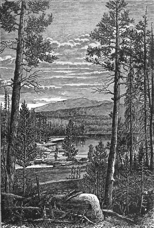
"Arctic Ural" extends from the 61st parallel
northwards for 1000 versts (about 670 miles) to the shores of the glacial
ocean. It is for the most part densely forested, almost impassable, and
characterized by an extremely severe climate. This tract was explored by the
so-called "Northern Expedition," in 1830-43,* and gold was discovered on the
head-waters of the rivers Petchora, Vishera, Shigor, and Vychegda, which
rise in the Ural, and along the basin of the northern Sosva, where the Pai-hoi
range begins. From experiments then made, the average yield was found to be
about I zolotnik (66 gr.) per 100 puds (3600 Ib.) of sand and earth. But the
region is so remote, inaccessible, and devoid of the necessaries of life,
that miners cannot venture into it, and its gold is therefore practically
useless. The following historic remarks concern the better known colonized
parts of the Ural range, southward from the 6oth parallel of N. lat. nearly
to Orenburg. They cover the time frame prior to the 1917 communist
revolution.
When Murchison, Count Keyserling, and De Verneuil explored this country in 1841, and published their great work on its geology, gold-mining was in its early stage of development, the alluvial deposits were only beginning to be worked, and washing was entirely done by hand, with the assistance of horses and oxen. In the 40 years that have elapsed since then, many remarkable changes have taken place, to which allusion will be made in the following pages, and it is probable that no part of Russia can show so much progress as the towns, zavods (ironworks), and mining centres in the Ural do at the present day. The Ural gold-mines and placers are of two kinds, those belonging to Government, and those owned by private individuals. To the former category belong the Bogoslofsk, Goro Blagodat, Ekaterinburg, and Zlataust groups ; in the latter, are included all gold-washings and –diggings belonging to private companies and individuals, situate on both flanks of the range, but mostly on the eastern [Asiatic] side, in the governments of Perm, Orenburg, and Ufa, as well as in the Uralsk territory.
The Individual
gold-fields:
(1) Bogoslofsk is the northernmost of the Government mining
establishments in the Ural. It was formerly noted for its production of iron
and copper, but this source of prosperity declined so materially that in
1837 the works would have been closed, had not rich gold bearing alluvial
gravels been discovered. Sir R. Murchison says that the Peschanka gold-mine,
near Bogoslofsk, had yielded from its discovery in 1829 to 1840, i.e. in II
years, 250 puds (9000 Ib.) of gold. According to another writer, 112 placers
had been opened to 1849, and the annual washings averaged 1,500 Ib., with a
proportion of zolotnik (44 gr.) to 3600 lb. of sand. The gold lies along the
Lozva and Sosva, tributaries of the Tavda, an affluent of the Tobol, and is
associated with diorite, serpentine, and sulphur-pyrites.
Murchison found the chief underlying rock to be greenstone, and the richest
alluvions lay immediately upon it.
No quartz veins have been found here, the gold grains being simply collected
by washing the finer sandy gravel. "The inspection of this locality," says
Murchison, "led us to believe that the gold had been diffused through the
subjacent rock, and that the auriferous epoch, or the close of it, was
marked by the scouring and denudation of the surfaces of the rock so
impregnated." The following details of production are borrowed from
Bogoliubsky's work: (468,720 lb.) of gold, in the proportion of 2 zolotniks
(131^ gr.) per cub. fathom of sand. Deducting the quantities extracted
before 1875, the remainder is n, $&$ puds (409,860 lb.), and supposing half
that quantity to be ultimately obtained, the value of the Bogoslofsk placers
may be represented by the sum of 1 2,392,0007.
(2) The next
Government mining district is Goro Blagodat, nearly due south of Bogoslofsk,
on the same side of the main axis of the Ural, in the government of Perm.
This district, which also comprises some large iron-foundries and
gun-factories, first came into notice with the discovery, in 1730, of the
rich hill of Blagodat (i. e. bountiful) famed for its magnetic iron-ore, and
not less memorable for the tragic event connected with the early settlement
of the Russians in this country, mentioned by Murchison.
The Kushvinsky gold-diggings in this district brought the Government an
annual revenue of 105,803 rubles (13,221 ). What has been done there more
recently it is impossible to say, for since the admission of private
enterprise in 1861, nothing is known of the results, no returns are
published, and there is a complete absence of information about it, which is
all the more surprising because the region is believed to be particularly
rich in minerals, and covers an area of about 2 million acres, including the
main axis of the Ural and its branches. Moreover, the position of this
gold-field, the proximity of numerous Government and private ironworks, make
it much easier to supply with all necessary instruments and machines than
the Bogoslofsk okrug, which is out of the way and ill provided with
communications.
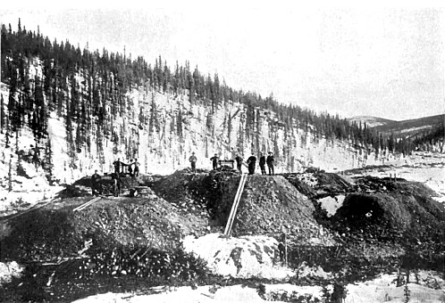
3) The Ekaterinburg group occupies the central Ural, and is important, no less from the town after which it takes its name, than for the zavods or works in the vicinity. Besides, it is easily accessible, being on the great Siberian highway, and for the last few years it has been connected with European Russia by a railroad. Within 2 hours' drive of Ekaterinburg, are the gold-mines of Beriozofsk, discovered in 1745, on the Beriozofka rivulet, a feeder of the Pyshma, by a peasant, Dorothy Markof. In those days, gold-washing was not understood, and attention was therefore exclusively turned towards quartz-crushing. In this way, 161 lb of gold was obtained to 1754. Not till 1814, was an attempt made to wash the alluvial gravels. Murchison visited Beriozofka mines in 1841, by which time 679 puds (24,444 lb.) of gold had altogether been obtained from 52,000,000 puds (8,300,000 tons) of ore-stuff. He says they are interesting to the geologist and mineralogist, in offering the only subterranean shafts in all this region, by which gold is still extracted from the parent rock. The chief fundamental rocks are talcose and chloritic schists and clay-slates, like those which prevail around Ekaterinburg, and these have been cut through by bands of a felspathic rock, called beresite, which Rose considers to be a decomposed granite a continuation, in fact, of the granites of the Shartash lake and Ekaterinburg.
The writer descended this mine in 1861 by a lateral gallery, and saw the process of extracting the alluvium by a shaft only 28 ft. deep. The soil or gravel was poor, much poorer than that formerly worked, yielding only about a third of a zolotnik instead of 2 to 2.\ zolotniks as formerly. Murchison mentions the maximum depth reached in his time as 28 fathoms (196 ft.), but these deeper borings were closed in 1861, owing to water, which made its way in from lake Shartash. Up to that year (1861), but little improvement had taken place in the art of washing the alluvium and quartz crushing ; the machinery was of the rudest kind, and economy of labor did not appear to be studied, though steam power had certainly been introduced, and thus 10,000 puds (360,000 lb.) of ore-stuff were washed per diem. But the director said that a second and even third washing produced better results than the first. In Hoffmann's time (1843), it took 28 million puds of sand to produce the annual quantity of 30 puds of gold which was formerly obtained from 6 to 8 million puds. From 1814 to 1874, 2201 puds (79,236 lb.) of gold had been extracted from these mines. But the Ekaterinburg washings were eclipsed by those of Eastern Siberia, where superior energy and enterprise made up for remoteness and other disadvantages. Beriozofsk has, within the last few years, with other Government establishments of the kind, passed into private hands, and is said to be doing well, its production having risen to 2160 lb. per annum. This gold, however, is mixed with a large quantity of alloy, in the proportion of about 12 per cent There is said to be enough alluvium to last for many years in the valleys which join the Pyshma, Reft, and Isset.
(4) In the southern Ural lies the highly metalliferous region of Zlataust (golden mouth), amidst ridges of hills, some of which rise to a height of several thousand feet. Zlataust itself (the town and the works) lies in 55 1 1' N. lat, and 77 26' E. long., 1230 ft. above sea-level, surrounded on all sides by hills wooded to their summits. In 1863, the population here numbered 25,708 males, mostly employed in the Government works. The gold-alluvium is found along the lateral streams which feed the Miass, a river flowing from S. to N. in a valley bounded on the W. by the main crest of the Ural, and on the E. by the Ilmen ridge, remarkable for the minerals and precious stones found there. The Miask diggings have been from the first among the richest in the Ural, both in the quantity of the gold found there and in nuggets. The largest of these weighed 79 lb., was found at the Tsarevo Alexandrofsk digging; it may now be seen at the museum of the mining corps at St. Petersburg. After the discovery of the Miask placers in 1823, their production rose so rapidly, that in 1827, 64 puds (2304 lb.) were extracted from them. Between this and 1849, the annual yield averaged about 50 puds (1800 lb.), and remained stationary at this for 10 years ; but in 1859, it suddenly fell to 1213 lb.
Almost due south of Ekaterinburg, in the district of Zlataust (golden mouth), famed for its steel cannon foundry and small-arms factory, in the government of Ufa, are the gold-fields of Miask, in the valley of the river Miass. The auriferous tract here extends over 1700 sq. versts (1060 sq. miles) and occupies a mineral belt 100 versts (60 miles) long by 20 to 30 (12 to 18 miles) wide. It is bounded on the east by the Ilmen hills, a ridge running parallel with the Ural, of which it forms an arm, remarkable for a variety of rare minerals found among its rocks. On the south, some detached hills, connecting the Ilmen with the main axis of the range, form the water-parting between the head-waters of the Miass flowing north, and those of another tributary of the Tobol the Ui flowing south. Silurian limestones and schists, penetrated and in some places metamorphosed by granites, porphyries, serpentine, and other igneous rocks, characterize this region. The schists, both argillaceous and talcose, overlie granite and limestone rocks, and are veined with berezite and auriferous quartz. The limestone is in places raised and rent asunder by diorite and serpentine masses, and these mainly compose the valley of the Miass, and distinct ridges, such as Nurali, Kumatch and Aushkul, whilst the Ilmen hills are mostly formed of granite, containing many rare and beautiful minerals. Down the eastern slopes of the main axis of the Ural and the western slopes of the Ilmen, flow numerous tributary streams, all remarkably auriferous.
The valley in which they meet is covered with superficial detritus rich in gold, Miask became known towards the end of the eighteenth century, when Ilarion Ivanovitch Luginin erected smelting furnaces here, and called his works Petropavlofsk, after the two saints Peter and Paul, who have long been believed to watch over the destinies of Russia. In 1798, these works were transferred to Government, and the very next year gold was discovered and machinery erected to wash it. At first, operations were confined to quartz, and the quantity of gold obtained was insignificant; but in 1823, attention was drawn to alluvial deposits, and these produced 50 to 64 puds annually, or about a ton on an average. This gold-field was divided into squares, having each a superficies distinguished by a separate name. In 1876, the Miask gold fields again became private property and their productiveness largely increased. These mines have produced some large gold nuggets up to half a pound in size. Some also show significant crystallization of the natural gold.
Continue on to:
The Witwatersrand Gold Deposits of South Africa
Return To:
Important Gold Mining Regions Worldwide