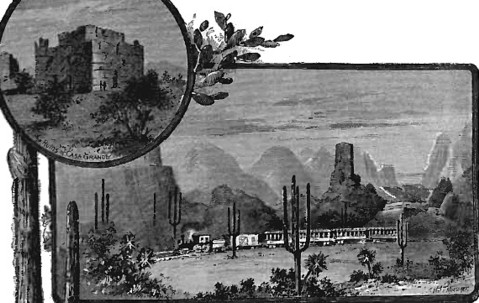
RED ROCK DISTRICT
This mining area lies adjacent to the Harshaw District on the northeast, and
eastward from the Sonoita River, extending to the summits of the Canelo
Hills. The mineral bearing areas are limited, and the formations are not
conductive to mineral occurrence. The principal properties are La Plata, New York, Meadow Valley, Copper Mountain and Sheehy Group. Ores
have been shipped from the New York,
La Plata and Meadow Valley
properties. In the Sheehy Group there has been done considerable work upon a
low-grade
copper ore proposition of large extent, which, with development, may
prove important. There are numerous small prospects showing very little
work.
WRIGHTSON DISTRICT
This district covers the east and southeast slopes of the Santa Rita
Mountains, the southern and eastern boundaries of the district being defined
by the Rio Sonoita. The north line intersects Old Baldy, a turn of that line
in a southeastern direction joins the east line at the river, a prolongation
thereof crossing the stream, continuing as the northeast line of the Red
Rock District. The greatest length of the district, from Old Baldy to the
Sonoita, near Patagonia, is twelve miles; the
greatest width is eight miles on an east and west line.The topography is
rough and altitudes vary from 3,500 to 6,500 feet, rising to 8,000 and 9,000
on the great summits in the north, with heavy erosion, deep canyons and
lofty ridges. Generally the mining claims follow the ridges, opened by
tunnels from the gulches and canyons, although that rule of development is
not universal. Chiefly the formation is andesite, a belt of the rocks 2 T/2
miles wide extending north and south across the west central portion,
flanked on the northwest in great part by the underlying
rhyolite, and partly by a narrow bowl of quartz
diorite and monzonite. On the south the country rock is
granite
porphyry. The eastern part is covered with quaternary gravels with
intrusions of older rocks. The ore deposits carry lead and
silver principally, with some copper, there appearing the
same tendency manifested elsewhere to increase in copper as depth is
attained. They occur in quartz bearing fissure veins or consist of
replacements in the igneous and
metamorphic rocks. In the Temporal
Gulch region there is a small belt of
gold quartz veins, the Gringo Mine presenting the most
notable example. The district embraces a half dozen or more camps, with a
score or more of small mines and prospects, and several hundred likely
claims to be given attention. There may be enumerated the Gringo, Happy
Jack, Anaconda, Mansfield Group, Ivanhoe, American Boy, Victor, Castle
Butte, Viceroy, Hosey, Castle Butte, Burro, etc.
GRINGO MINE
This mine is a
gold producer, is in the southern part of the district, about
three miles northwest from Patagonia, at an elevation of about 4,200 feet.
The discovery was made in 1893, but no work of any consequence was done
until 1906. For a time a five-stamp
mill was in operation. Later an
additional battery was installed, and increase to twenty stamps is
contemplated. The property embraces a group of nine claims extending 4,500
feet on the veins, of which there are two running through the ground the
Gringo and the Independent. The principal development is in the Gringo vein,
which is five to twenty feet in width, nearly vertical in position. The vein
filling is quartz. The ore body goes as wide as fifteen feet, all good
milling
gold ore. The gold is fine and well disseminated, although
the higher values are next to the footwall. The rock runs about $10 to the
ton in gold, carrying also a little silver, lead and copper.
The Independent vein, about 600 feet from the Gringo, and approximately parallel, is in general fifteen to twenty feet in width, and at the junctions of several spurs it widens to about forty feet. The spurs make as good a surface showing as the main vein. The Independent ore averages about $9 per ton. The plates recover about $5 per ton, while a greater part of the remaining values are saved by concentration. The ore bodies are very large and will supply production through a long period of time. Development is by a shaft 180 feet deep in a deep depression in the ground. Two levels extending several hundred feet east and west make depth rapidly and as extended give increasing backs. Other shafts on higher ground are sinking, but no deeper than a line level with the collar of the main shaft. The country rock is andesite, but by the veins, the filling in which is quartz principally.
MANSFIELD MINES
The property of the Ruby Copper Company, successor to the Mansfield Mining &
Smelting Company, are in Mansfield Gulch, a tributary of Temporal Gulch,
about six miles north from Patagonia. The holdings embrace about forty claims. The principal development is
on the Black Cap, Ruby and Sweet claims, aggregating more than 4,000 feet of
work. At present operations are confined to the Ruby, where is the Lee shaft
425 feet deep, with drifting nearly 300 feet on the ledge in good ore. It is
at the extreme west end of the group, near the head of the gulch. The Sweet
Mine, which is at the lower part of the gulch, near Temporal, in which gulch
lies the camp, has a 360-foot shaft, with levels 100 feet apart. The showing
of ore is good. The Black Cap is opened by a shaft 140 feet deep, connected
at the bottom with a 200-foot tunnel. Good shipping ore has been marketed
from this property. Near the camp there is a small smelting furnace in which
ores from the Sweet Mine were smelted. Work is progressing steadily and
development accomplished gives promise of a great and profitable enterprise.
The country rock consists of
quartz monzonite and rhyolite in chief, with andesite. Some
of the ledges seem in contacts between the rhyolite an quartz monzonite.
AUGUSTA MINE
The August property is one of the so-called Hosey or Presidential Group, in
the immediate vicinity of the Black Cap and Ruby. The group embraces seven
claims, the principal work being on the Augusta. Upon two levels, 100 and
200 feet below the collar of the shaft, which is 215 feet deep, there are
more than 1,000 feet of development. Running through the property are three
veins, the chief development being on the south vein, which is from eight to
fifteen feet in width. A four-foot ore chute averages 12% copper, carrying a
little
native gold and silver. Through several months' time, under a
former management, ore shipments averaged twenty tons a day. Recently the
property has been taken over by Mr. W. B. Ramsdell, an operator in mines of
extensive experience, who is represented by Mr. Colin Timmons, a veteran
mining engineer with wide experience in Colorado,
Arizona and Mexico.
The new management has started a new working shaft on the same ledge at a point 300 feet east of the present shaft. The grading done for the new working shows a great ledge more than 100 feet wide, and as the ground rises rapidly above the shaft site, depth will be attained very fast. Every indication points to a great ore body below. Upon another ledge, about 150 feet north of the old shaft, work of sinking upon another ledge is in course of prosecution, and it is at a depth of about 100 feet. The pay streak is thirty inches wide and it is yielding grey copper high in values. The work was commenced to perform the assessment work for the year 1915. The ore taken out from the first was so good that it was shipped at a handsome profit, and there has been no reason to stop.
HAPPY JACK MINES
This mine consists of a group of nine claims, not far south from the Black
Cap property of the ,Mansfield group. The Happy Jack Mining & Reduction
Company, of which Mr. W. H. Barnett, of Patagonia, is general manager,
operates the property. Upon the dump there are several hundred tons of good
concentrating ore, and there have been shipped a number of carloads of
high-grade rack that averaged about 42% lead with 2.2 % copper, twenty
ounces silver and $2 gold per ton. The ground is cut by several veins, the
principal one, on which was done the development, being in the middle. The
aggregate work exceeds 4,000 feet. The main or lower tunnel is 900 feet
long, 400 feet below the croppings. The other tunnel is 200 feet higher. At
600 feet the two are connected by an upraise.
AMERICAN BOY MINE
This mine is in the same vicinity and northwest from the Black Cap. The
owners, Jens Peterson and George Clarke, have worked the mine in a small way
about ten years, making occasional shipments of high-grade ores. Development
has been by tunneling.
Return
to The Arizona Page:
Arizona Gold Rush Mining History